Project / 02
SolarScope
Full-stack solar estimation platform combining rooftop mapping, spatial calculations, solar potential estimates, and homeowner lead capture.
Overview
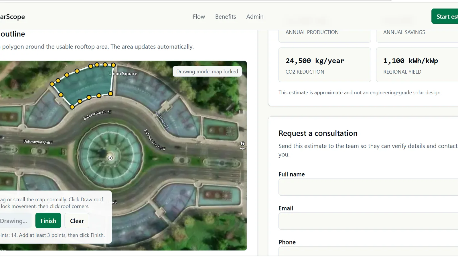
SolarScope guides a homeowner from address search to an indicative solar estimate through one map-led experience.
It combines rooftop geometry, spatial calculations, renewable-energy data, estimate metrics, and a consultation request workflow.
Challenge
An early-stage solar assessment must translate a physical rooftop into usable area and energy estimates without presenting the result as an engineering-grade design. It also needs to keep a technically complex mapping flow understandable for homeowners.
Solution
The Next.js application uses Mapbox for satellite mapping and address context, Turf.js for polygon and area calculations, PVGIS data for solar potential inputs, and Supabase for lead capture and administration. Zod validates the data passed between the estimation and inquiry steps.
Key Features
- 01Address search
- 02Satellite map context
- 03Interactive rooftop polygon drawing
- 04Roof area calculation
- 05Solar production, savings, and CO2 estimates
- 06Homeowner lead capture
- 07Administrative lead dashboard
Technology
Frontend
Database / Auth
GIS / Mapping
Infrastructure
Other
Rima’s Contribution
Rima built the map-based estimation flow, rooftop drawing interaction, calculation presentation, responsive interface, lead-capture journey, and supporting Supabase workflow.
What This Demonstrates
SolarScope demonstrates full-stack geospatial product development in a renewable-energy context, connecting spatial interaction, calculations, data validation, and business lead workflows.
Next step
Interested in a similar project?
Explore the live application, return to the portfolio, or get in touch to discuss a practical web, data, or geospatial product.