Project / 01
Ploterra
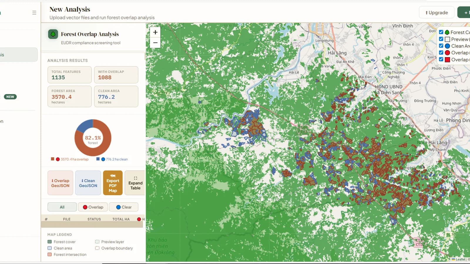
Production GIS platform for parcel-based deforestation analysis with raster processing, authenticated history, cloud storage, and PDF reporting.
Overview
Ploterra is a production GIS platform for screening land parcels against forest-cover data and preparing EUDR compliance analysis.
The product combines authenticated project history, raster selection or upload, vector analysis, cloud storage, and downloadable map reporting in one workflow.
Challenge
Deforestation screening requires uploaded parcel boundaries to be validated and compared with large raster datasets while keeping results understandable, traceable, and ready to share. The workflow must handle spatial reference systems, raster and vector formats, processing limits, and long-running analysis without losing the user’s project history.
Solution
A FastAPI processing service coordinates validation and geospatial operations with Rasterio, rio-tiler, Shapely, PyProj, NumPy, and Pillow. Supabase provides authentication and protected history, Cloudflare R2 stores raster assets, and the interface presents overlap results, maps, GeoJSON exports, and PDF reports.
Key Features
- 01Authentication and protected analysis history
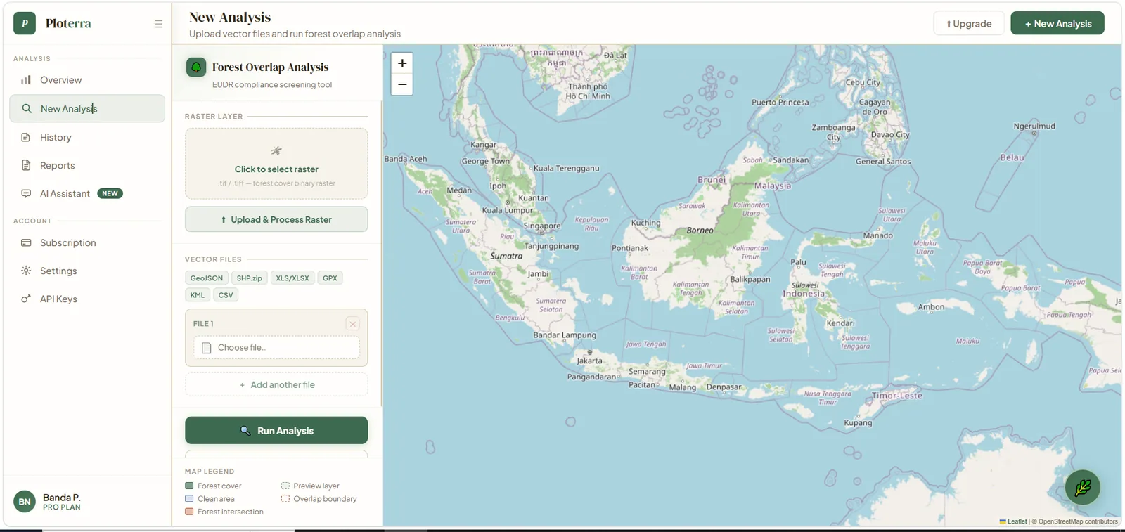
- 02Raster selection and manual raster upload
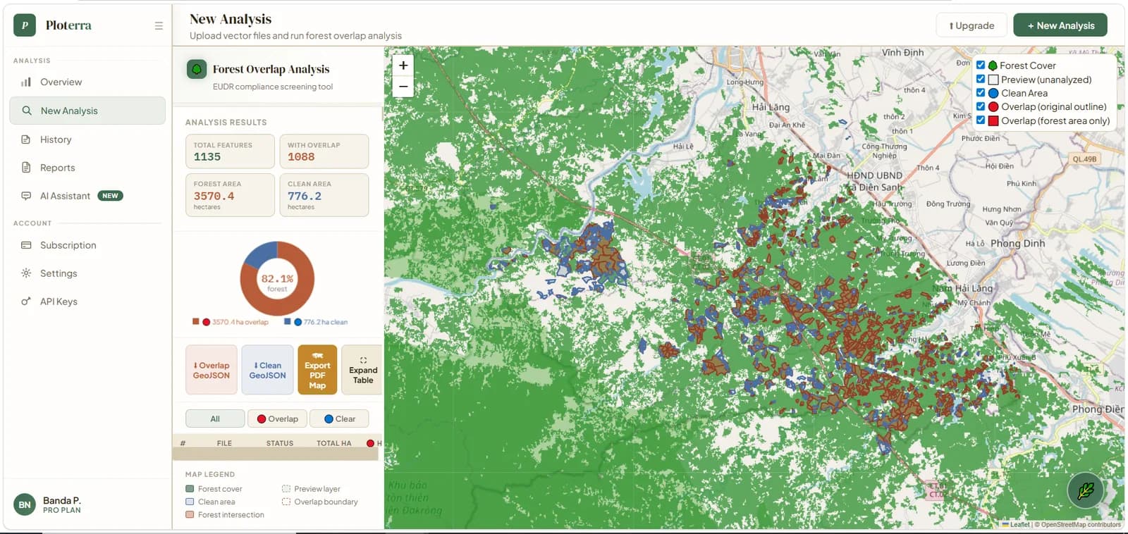
- 03Raster and vector overlap analysis
- 04Deforestation analysis for parcel data
- 05Interactive result mapping
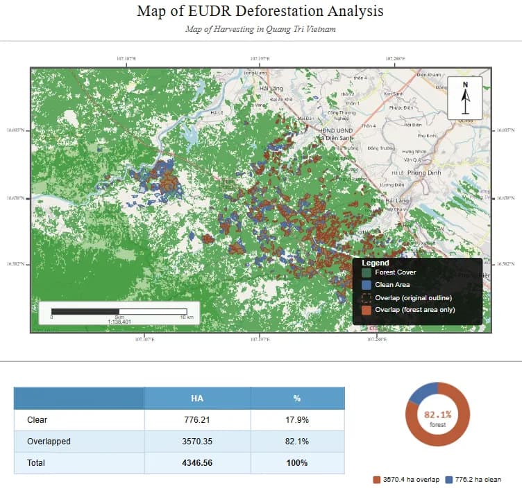
- 06PDF map and report export
- 07Cloud raster storage
- 08Validation, rate limiting, logging, automated tests, and CI
Technology
Frontend
Backend
Database / Auth
GIS / Mapping
Infrastructure
Rima’s Contribution
Rima’s contribution spans the full-stack product workflow: application structure, authenticated analysis history, upload and validation flows, raster and vector processing, interactive result presentation, cloud-storage integration, reporting, automated tests, CI, and deployment.
Gallery
What This Demonstrates
This project demonstrates production full-stack GIS development across spatial processing, authentication, cloud storage, reporting, testing, and deployment.
Next step
Interested in a similar project?
Explore the live application, return to the portfolio, or get in touch to discuss a practical web, data, or geospatial product.