Project / 03
GeoProp Insights
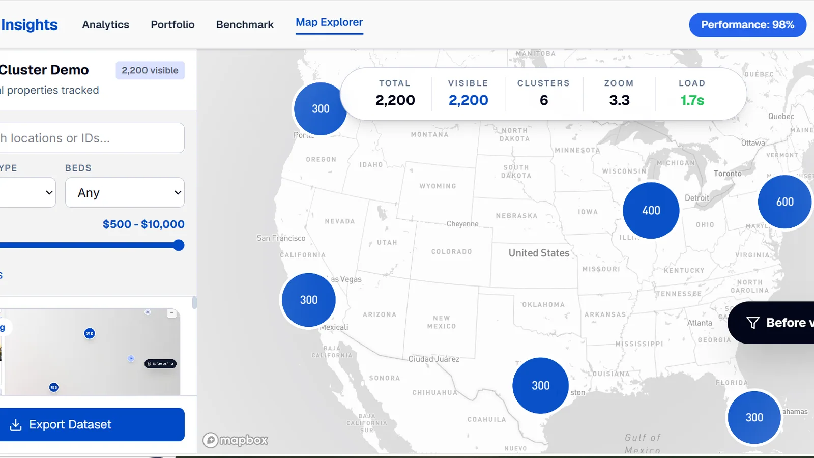
Interactive rental-property explorer using Mapbox clustering, search, and filters to visualize more than 2,200 property records efficiently.
Overview
GeoProp Insights is an interactive rental-property explorer built around a dataset of more than 2,200 records.
The interface coordinates a searchable property list with clustered Mapbox data so users can move between overview and individual listings efficiently.
Challenge
Displaying thousands of property markers at once can make a map slow and visually unreadable. Search, filters, cards, popups, and camera movement also need to stay synchronized as users explore the dataset.
Solution
The prototype represents property records as GeoJSON and uses Mapbox GL JS clustering to reduce visual and rendering load. Search and property filters update the displayed data, while cards and popups provide direct fly-to interactions.
Key Features
- 01Dataset of more than 2,200 property records
- 02GeoJSON marker clustering
- 03Location and listing search
- 04Property and price filters
- 05Synchronized property cards and map popups
- 06Fly-to map interactions
- 07Map performance comparison
Technology
Frontend
GIS / Mapping
Infrastructure
Other
Rima’s Contribution
Rima implemented the data-to-GeoJSON workflow, Mapbox clustering, filters, search, property cards, popups, map navigation, performance comparison, and automated frontend tests.
What This Demonstrates
This project demonstrates performance-conscious geospatial frontend development for high-volume property data and tightly coordinated map and interface interactions.
Next step
Interested in a similar project?
Explore the live application, return to the portfolio, or get in touch to discuss a practical web, data, or geospatial product.